Marker Image:
County:
Where Found:
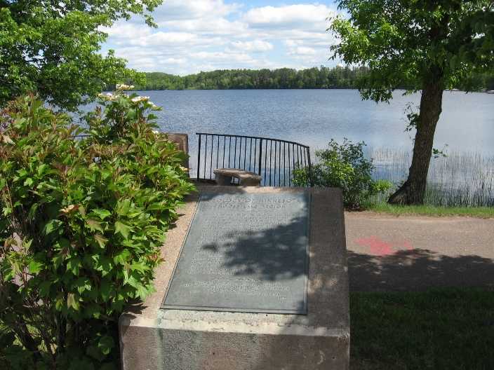
Located on U.S. highway 61 in a wayside park at the south edge of Moose Lake
Wayside park in Moose Lake, by river bridge , Lakeshore Drive and Arrowhead Drive
Text On Markers:
MOOSE LAKE REGION
Toward the end of the great ice ages about 10,000 years ago, the glacier, which had pushed its way along the trough of Lake Superior, retreated toward the northeast, and near Moose Lake crossed the divide between the Mississippi River and Lake Superior. When the lobe of ice was shrunken so that it lay wholly within the rim of the lake basin, Glacial Lake Nemadji was formed around the southwest margin of the ice.
The earliest outlet was at this, the western, end, when the lake stood 523 feet above the present level of Lake Superior and nearly reached the elevation of the State Hospital in the distance. During the centuries of drainage from here through the Moose River to the Mississippi, this channel was eroded downward to the present level. When lower outlets for the Lake Superior basin were opened, the Moose River Valley was abandoned as an outlet, and this part of the ancient water-course became the basin of Moosehead Lake.
Erected by the Geological Society of Minnesota and the Department of Highways, State of Minnesota aided by a grant from the Louis W. and Maud Hill Family Foundation. 1955
Marker Number:
Region:
Marker Location:
Date Update:
Marker Current Status:
Found. At map pointer.
Erected by the Geological Society of Minnesota,MnDot, grant from the Louis W. and Maud Hill Family Foundation. 1955.
From I-35, take exit 214 in Moose Lake. Turn left onto Route 73 and go west. This is also known as Industrial Park Road. It will soon merge with Route 61 (Arrowhead Lane). At the corner of Arrowhead Lane and Lakeshore Drive is a park – the Ervid Clemons rest stop. Marker is in this park, overlooking the south shore of Moosehead Lake.
Information Needed:
- Marker Images
Condition of Marker:
- Good