Marker Image:
County:
Where Found:
Located on state highway 210 in a rest area in Jay Cooke State Park
Text On Markers:
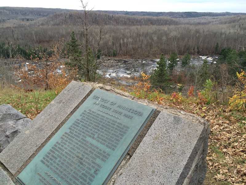
JAY COOKE STATE PARK
This point overlooks the St. Louis River Valley. The steeply inclined rocks in the river channel upstream are alternating beds of slates and graywackes of the Thom-son formation, thousands of feet thick.
Slates are rocks formed from original deposits of mud which are first compacted into shale and subsequently converted into slate by heat, pressure, and movement in the earth's crust. Graywackes originate as beds of sand with enough gray and black grains to produce the dark color.
These original sediments collected on the sea bot-tom about two billion years ago and subsequently, by deep-seated earth movements, were folded, fractured, and tilted to stand at varying angles.
Glacial ice, moving over this area, completely filled the Lake Superior basin and blocked the natural drainage through the St. Lawrence River. The meltwaters from the ice, unable to flow eastward, created a glacial lake standing 500 feet higher than Lake Superior. At this stage the water reached Jay Cooke Park and the red lake-clay sediments, found in the road cuts in the park and in the valley downstream from this location, were deposited.
Erected by the Geological Society of Minnesota and the Department of Conservation State of Minnesota. 1960